 ES
BRAÑAS DE SALIENCIA ROUTE
Brañas de Saliencia route (PR.AS - 12)
Route type: Linear
Distance: 8 km
Duration: 3h 15min
Elevation gain: 350 m
Difficulty: Moderate
Route map and elevation profile
- Total ascent514 m
- Total descent399 m
- Highest point1,388 m
- Lowest point993 m
Elevation profile
Use two fingers to move the map
Track based on OpenStreetMap (© its contributors, ODbL licence); elevation from the Copernicus EU-DEM model. For guidance only: always follow the waymarks.
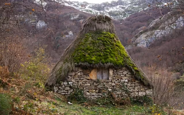
The Brañas de Saliencia route (PR.AS-12) links the villages of Arbeyales and Saliencia in 8 km. It climbs through the La Güérgola gorge, on a path paved by the villagers beside the stream’s waterfalls, and passes the brañas of Ordiales de Arbeyales, Culiao and Ordiales de Éndriga. It is linear: 350 m of ascent and 3 h 15 min.
Split times
Times from Arbeyales, according to the official trail sheet:
| Point | Time |
|---|---|
| La Güérgola | 30 min |
| Braña de Ordiales de Arbeyales | 1 h 30 min |
| Braña de Culiao | 2 h |
| Braña de Ordiales de Éndriga | 2 h 20 min |
| Mortera de Saliencia | 2 h 50 min |
| Saliencia | 3 h 15 min |
Route description
The walk starts in the village of Arbeyales, taking the path that crosses the hamlet to the bridge over the Regueiru de Murias. It continues up a steep path that climbs with the stream on the left and passes through La Güérgola.
Paved by the villagers, with real steps in places, the path is accompanied by the cheerful chatter of the water as it tumbles down in countless waterfalls. At the end of the gorge, after crossing another bridge, the path forks.
The route continues along the right-hand path, which leaves the riverbank and climbs the slope towards the Braña de Ordiales de Arbeyales. This is the moment for a short rest to enjoy the splendid view, across the valley, of the Monte Grande and the channel that crosses it, a conduit that carries water from the Saliencia lakes to the La Malva power station.
At the braña itself, take the track that leads across the slope, through broom scrub, to the Braña de Culiao, after crossing the Regueiru de Castro and passing two drinking troughs. From El Culiao the route continues along the same track to the Braña de Ordiales, used by the residents of the village of Éndriga. This point has magnificent views of the Saliencia valley: you can make out the glacial shaping of its head, with the characteristic U-shaped section, and, downstream, the narrowing of the valley, typical of river erosion, with a V-shaped section.
All that remains is to follow the same track and, after crossing the Regueiru de Borbolla, reach the Mortera de Saliencia, the last braña on the route, and descend to the village of Saliencia, where the route ends.
Notes: visitors who do not have time for the whole route can enjoy a short walk from Arbeyales to the Braña de Ordiales de Arbeyales through the Foz de la Güérgola gorge, returning the same way. A second option is to drive to Saliencia and then climb to the Braña de la Mortera de Saliencia. The route between the Braña de Ordiales de Arbeyales and the Mortera de Saliencia crosses private land used for growing hay. For that reason, do not leave the path while the hay has not yet been cut. Along the way you may see the majestic flight of griffon vultures and even spot Egyptian vultures.
Download the route map (PDF, in Spanish)