ES
Somiedo Natural Park in figures
Somiedo Natural Park lies in the central-western part of the Asturian mountains, in the heart of the Cantabrian Mountains and bordering León. It covers the whole municipality of Somiedo and was the first Natural Park declared in Asturias, in 1988. Since 10 November 2000 it has also been a Biosphere Reserve.
- 283 km² of natural park
- 4 valleys Somiedo, Valle de Lago, Saliencia and Pigüeña
- 39 villages and hamlets, and about 1,500 residents
- 2,194 m at El Cornón, its highest point
- 400 m at Aguasmestas, the lowest
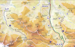
- 13 trails waymarked for walkers
What the park is like
The territory is organised into four valleys, those of the rivers Somiedo, Pigüeña, Valle and Saliencia, and there is not always a direct road between them. The main village is Pola de Somiedo; the rest are in the villages of Somiedo, and the approaches in how to get there.
The high ground holds the lakes of Somiedo: the Saliencia lakes (La Cueva, Calabazosa and Cerveriz) and Lago del Valle, the largest in Asturias, which owes its present size to the works that raised its level for the La Malva power station. Together they form the Somiedo lake complex, a Natural Monument.
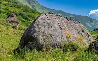
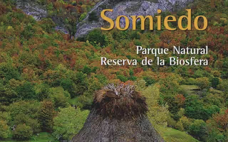
The marked difference in altitude, from 2,194 m at El Cornón down to 400 m at Aguasmestas, combined with the climate, shaped a way of life based on mountain farming and transhumance. Hence the brañas, the high pastures where the thatched teito cabins were built. Livestock farming remains the main economic activity in Somiedo, though Natural Park status has brought a notable rise in tourism.
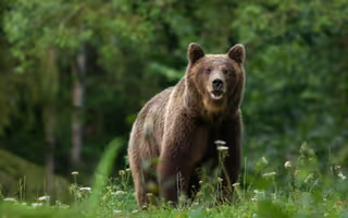
Much of the park is covered by woodland, scrub, brañas and pasture, home to an important population of Cantabrian brown bears.
Park Interpretation Centre
The Natural Park's Reception and Interpretation Centre is in Pola de Somiedo (telephone +34 985 763 758). It is the place to ask for maps and information on the trails before setting out.