 ES
EL CORNÓN ROUTE
El Cornón route (PR.AS - 10)
Route type: Out and back
Distance: 7 km
Duration: 4h 30min
Elevation gain: 700 m
Difficulty: Moderate
Route map and elevation profile
- Total ascent738 m
- Total descent68 m
- Highest point2,152 m
- Lowest point1,460 m
Elevation profile (one way)
Use two fingers to move the map
Track based on OpenStreetMap (© its contributors, ODbL licence); elevation from the Copernicus EU-DEM model. For guidance only: always follow the waymarks.
The El Cornón route (PR.AS-10) climbs from Santa María del Puerto, on the Somiedo pass, to El Cornón, which at 2,194 metres is the highest point in the municipality. It crosses the bridge over the river Bayo, runs across the slope above the Vega de Penouta and passes Las Mozarras. The trail sheet gives 7 km and 700 m of ascent and allows 4 h 30 min for the climb; you come down the same way.
Split times
Times from Santa María del Puerto, according to the official trail sheet:
| Point | Time |
|---|---|
| Río Bayo bridge | 30 min |
| Las Mozarras | 2 h 30 min |
| El Cornón | 4 h 30 min |
These are times for the ascent.
Route description
The route starts at the Puerto de Somiedo, crossing the village of Santa María along its western edge to pick up, on its outskirts, a track restricted to residents and livestock farmers. Always taking the left-hand turnings, you soon reach the bridge over the Río Bayo. From this point the climb continues across the meadow to find the path that runs alongside the water supply of Santa María del Puerto.
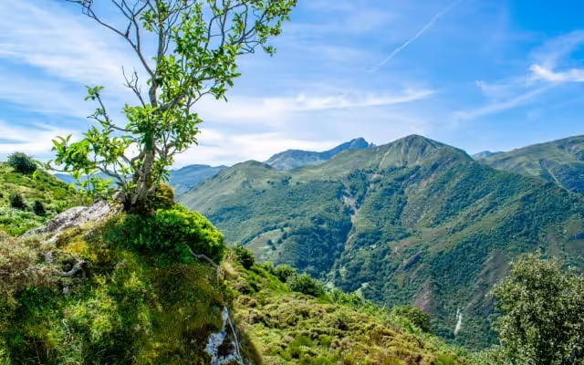
Following the same track, the walk reaches the start of the Veiga Cimera valley. From here, climb to the right to reach a small flat area. Once across it, on its left-hand side, there is a col from which the route continues across the slope above the Vega de Penouta. All along this stretch you can see Peña Penouta to the right of the path and, to the left, the crests of Picu Prefustes and Miro Malo. A fine col with views of the Pico del Cornón is soon reached.
Crossing the col and after a slight descent down a small valley, the path reaches Las Mozarras, a siliceous plateau carpeted with subalpine scrub, where creeping juniper and bilberry abound, furrowed by a multitude of rivulets that create a broken landscape dotted with small boggy patches. Peña Blanca and El Fontanón are left on the right and the base of El Cornón is reached; the summit is climbed by the so-called escalera del Cornón (the Cornón staircase), on the south face, for unbeatable views over the mountains and meadows that form the boundary between Asturias and León. On a clear day, this height also gives a splendid view of the Cantabrian Mountains, from Las Ubiñas, in the municipality of Quirós, to Pico Miravalles, in Ibias, and even of the sea.
Notes: El Cornón, at 2,194 metres, is the highest point in the municipality of Somiedo. Rising on white quartzite, it is covered with countless species of lichen which, depending on the light and humidity, give it different colours; its changing hues are striking.
Along the way, if you walk quietly, it is easy to see groups of chamois grazing. Many birds of prey can be seen too: buzzards, kestrels, honey buzzards, short-toed and golden eagles, Egyptian vultures and griffon vultures, and occasionally even storks, as this is one of the few places in Asturias from which the species can be seen.
Download the route map (PDF, in Spanish)