 ES
EL PUERTO – VALLE DEL LAGO ROUTE
El Puerto – Valle del Lago route (PR.AS - 16)
Route type: Linear
Distance: 9.5 km
Duration: 4h 30min
Elevation gain: 200 m
Difficulty: Moderate
Route map and elevation profile
- Total ascent369 m
- Total descent632 m
- Highest point1,823 m
- Lowest point1,228 m
Elevation profile
Use two fingers to move the map
Track based on OpenStreetMap (© its contributors, ODbL licence); elevation from the Copernicus EU-DEM model. For guidance only: always follow the waymarks.
The El Puerto – Valle del Lago route (PR.AS-16) starts at Santa María del Puerto, a vaqueiro braña at 1,485 metres on the Somiedo pass, and reaches Valle del Lago over the Putracón and Peña Salgada passes and the Braña de Sousas. It is 9.5 km one way, with 200 m of ascent and 4 h 30 min.
Split times
Times from Santa María del Puerto, according to the official trail sheet:
| Point | Time |
|---|---|
| Collado del Putracón | 1 h 05 min |
| Collado de Peña Salgada | 2 h 10 min |
| Valle de la Salgada | 2 h 25 min |
| Braña de Sousas | 3 h 20 min |
| Valle de Lago | 4 h 30 min |
Route description
At the Puerto de Somiedo, at 1,485 metres, lies the village of Santa María del Puerto, a vaqueiro braña two kilometres from the border with León, at the head of the river Sil.
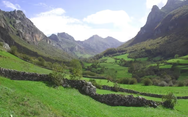
The route starts in this village, on a path that leaves beside the first house, to the left of the road. In its first stretches it runs between the dry-stone walls (murias) that separate the hay meadows. Along the left-hand side of the small gully of the El Urdial stream, the path reaches an open pasture and, after crossing it, turns right, leaving the crags on the left. A slight climb leads to the Collado del Putracón, where a wire fence separates the pastures of Asturias and León. This is a good place for a first stop, to look east to Peña Llana and south to the Rebezu valley.
Heading east all the time, with the crag on the left, the path reaches a col with, on one side, a fine view of the Somiedo mountains and, on the other, to the right, the Leonese valley of El Rebezu: you can appreciate the difference between the gentle meadows of León and the rugged valleys of Somiedo. A steep slope takes the path down from the col to the valley floor, where it heads east and, skirting the Peña el Micho on its northern side, brings into view a glacial scree and the Braña de Sousas.
A stop at this braña lets you look closely at its layout and buildings. The stone huts, corros, are circular in plan and end in a false dome, covered with sods of turf (tapinos) for better insulation against the cold and the rain. Within the braña the corros are normally grouped in pairs, the second one serving as shelter for the young animals. There are other structures in the braña too, the olleras: cool stores used to speed up the cooling of freshly drawn milk, so that the cream could easily be skimmed off to make butter. In Sousas the olleras are underground, and water from nearby springs is channelled through them.
At the end of the braña, beside the Sousas stream, starts the path down to Valle de Lago. About 600 metres from its start, a footpath branches off which, without losing height, leads to a viewpoint over the village of Coto through the Peña Furada or Castiellu, and then descends to rejoin the path to the end of the route in Valle de Lago.
Download the route map (PDF, in Spanish)